The headwaters of the Shenandoah River emerge in two locations in the Appalachian Mountains to create the North and South Forks, which flow northeast in tandem before merging at Front Royal. Forty-two miles later, the unified Shenandoah merges with the Potomac River at the town of Harpers Ferry, an enduring stopover for travelers, dignitaries, presidents, and pioneers. Like the Natural Bridge or the caves at Luray, Harpers Ferry is one of the geological wonders of the region. There’s no other way to describe this confluence of two formidable rivers other than to say it’s a spectacularly dramatic landscape. It’s also an incredibly busy landscape, run by a cadge of Peregrine falcons circling above and overrun by a flock of tourists in search of trash cans for their plastic spoons.
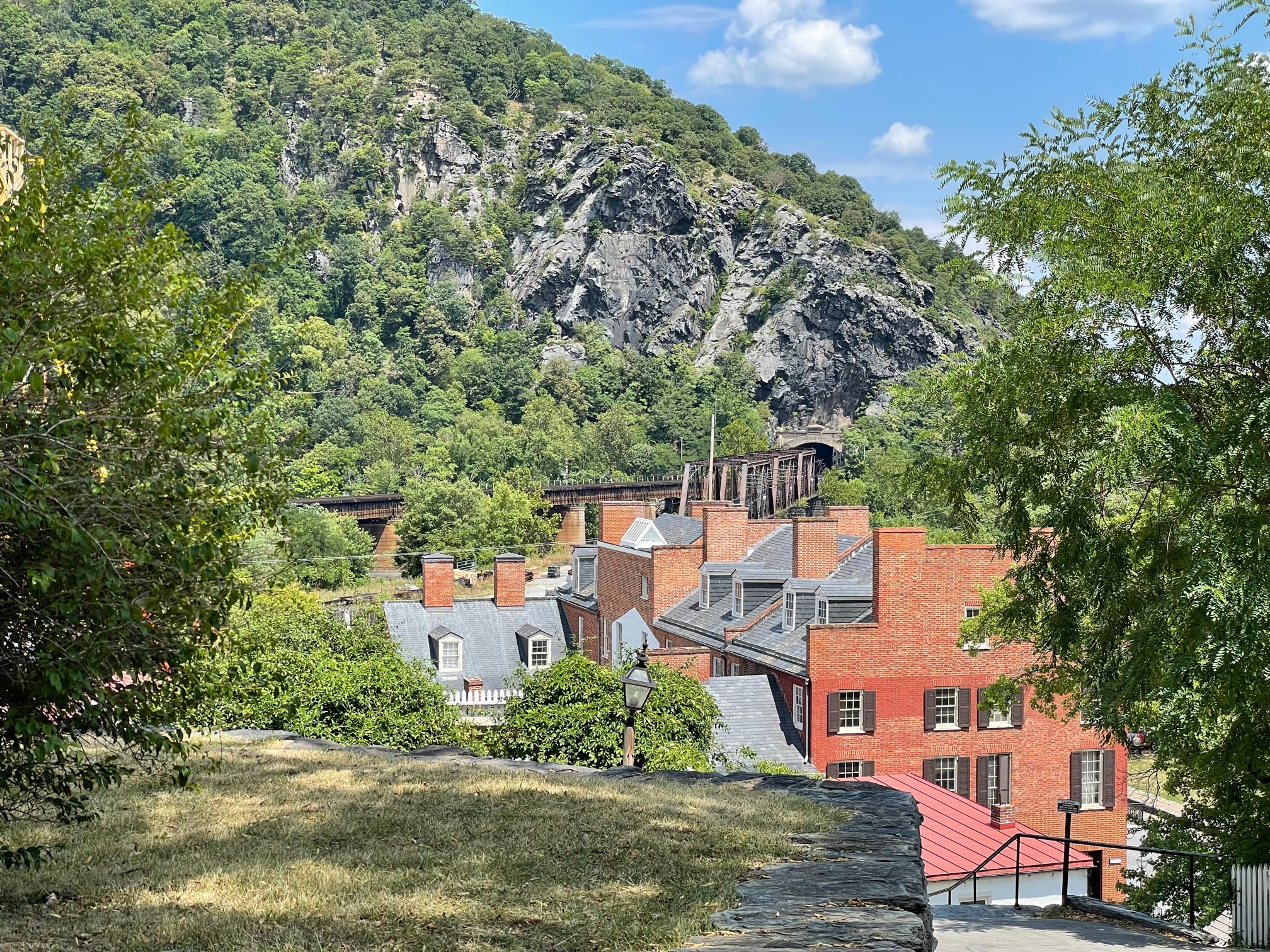
The town, enveloped by a National Historic Park since 1944, caters to more than half a million visitors each year whose stores sell rocks and socks and sandwiches and sundaes. On a recent summer’s Sunday visit, English, French, German, and Hindi could be heard over the din of chatter and children, and daytrippers from D.C. mingled in what’s called the Lower Town with cyclists, backpackers, and overnighters. The Lower Town and everything above it unfolds along a tight urban plan that squeezes as much of a regular grid as possible into an irregular mesa barely 2,000 feet across. Two streets run like train tracks along the flattest part until one ekes out the other and runs down to the fabled Point marked by bronze plaques and an uninterrupted view of two rivers beyond.
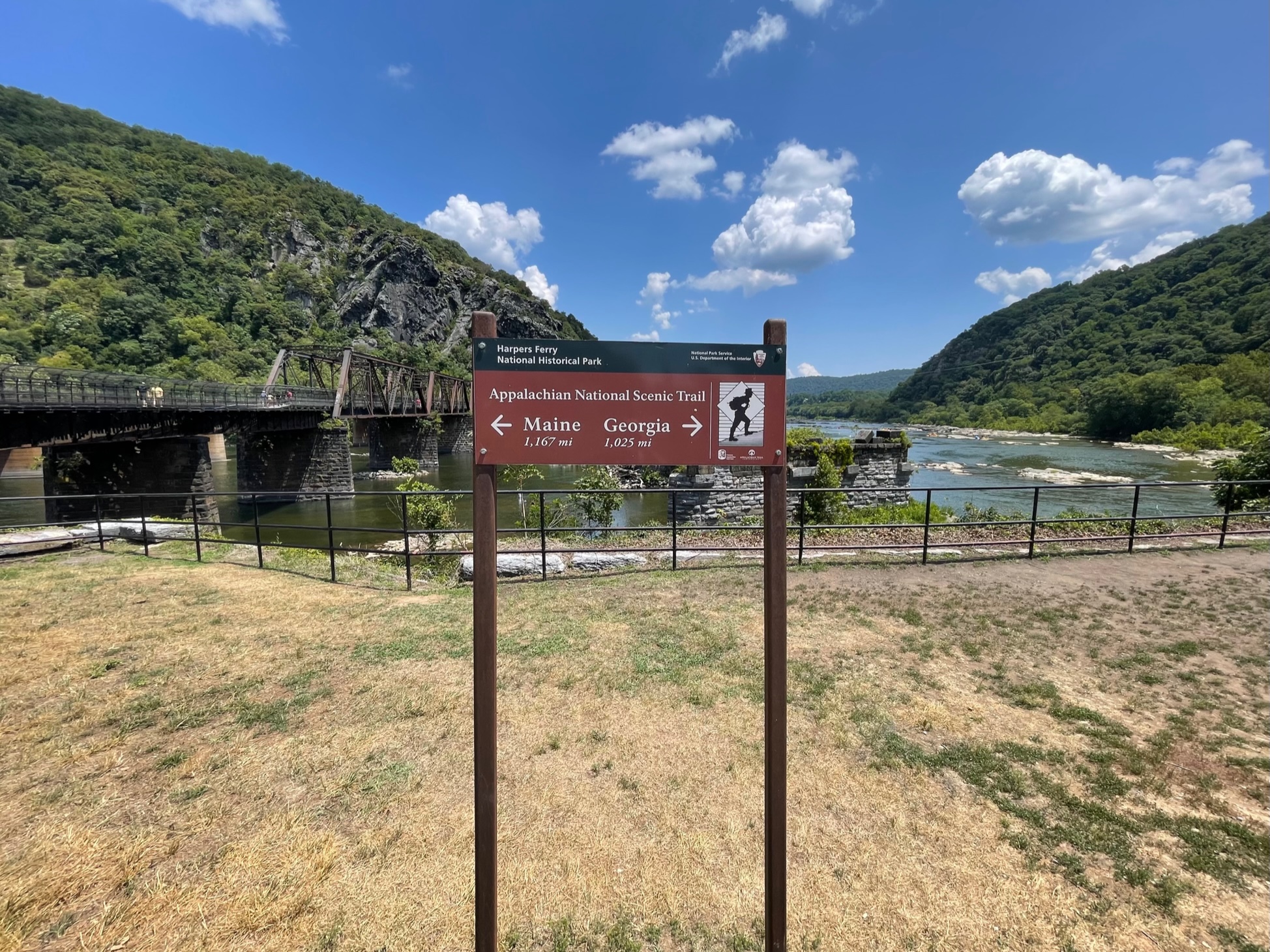
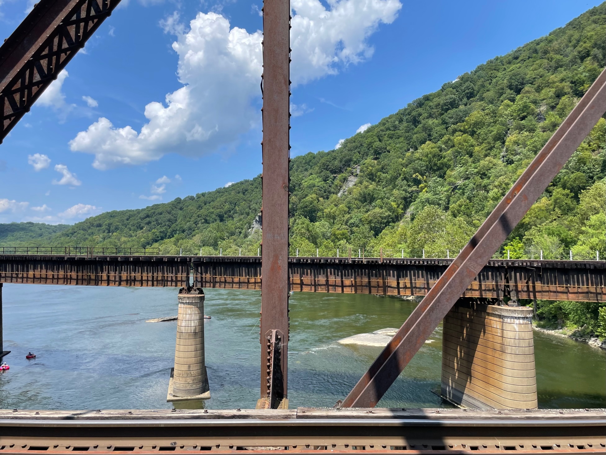
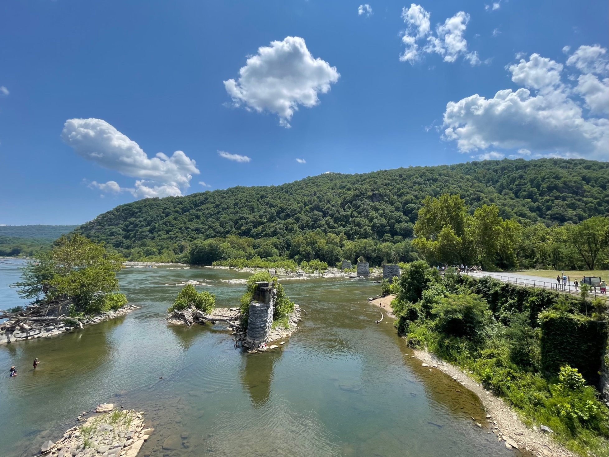
Mercifully, the Point is also unbothered by hot dog vendors or t-shirt hawkers. Visitors are free to gather for selfies or to read the faded Park Service panels illustrating the natural phenomenon before them. They come to learn the history of a place all but destroyed during the Civil War (and long since rebuilt by local merchants and the National Park Service to its pre-war glory). They come for the industrial beauty of an active trestle bridge next to abandoned viaduct piers, not to mention the defensive structures that define the riverfront itself. They come for the natural beauty of this respite near the midway point of the Appalachian Trail between Georgia and Maine. They come for a good time, too, and the ancillary industries of tubing, kayaking, and canoeing.

But, mostly they come to see John Brown’s Fort and the place where, in 1859, Brown attempted to raid the federal armory at Harpers Ferry (one of only two in the entire U.S. at the time), galvanizing the abolitionist cause. Brown’s larger strategy centered on the snowball effect—to generate enough momentum and accumulate enough people to fuel a slave rebellion. In Harpers Ferry, he hoped to capture (along with 22 abolitionists) upwards of 100,000 muskets and rifles and hold the armory long enough to attract area slaves and sympathizers. Then he’d arm them for a bloody campaign that would move south along the ridge of the Appalachian Mountains in the hopes of freeing and arming other slaves along the way. Of course, that would not be the outcome and the eponymous fort that is associated with John Brown today was never part of his plan—nor was it a fort at all, but the armory’s garage for fire engines that became a fallback position for Brown and his dwindling party of raiders who would all be killed by federal troops or later tried and executed in Virginia (Brown among them).
Most scholars agree that their deaths cemented Lincoln’s first presidential victory in November 1860 over his three opponents (including, notably, Stephen A. Douglas) and catalyzed the secession of 11 southern states—in the “cause of Disunion”—beginning in December 1860 and lasting into 1861. Sitting as it does today at the nexus of West Virginia, Virginia, and Maryland, Harpers Ferry certainly had a special political significance for Brown. And, sitting as it does at the nexus of the Chesapeake and Ohio Canal and the Baltimore and Ohio Railroad, the town continued to have a special tactical significance throughout the war for two armies. Harpers Ferry changed hands several times over the course of five years in bloody and bloodless ways, its military structures often set afire by both sides to thwart the enemy and its town left battered. One Union officer noted in March 1862, about halfway through the war, “It is really, or rather was, a town of some note, but the ruin, absolute devastation now in its place is beyond anything I ever dreamed or saw or heard tell of.”
Today that history has been expunged by new development and its ramparts have been cleaned up for tourists and history buffs. You’re more likely to see a discarded carabiner on the side of the road than a bullet casing. Much of the Lower Town has been reconstructed and even John Brown’s Fort—whose bricks traveled quite a bit after the war before being reconstructed at Harpers Ferry—bears virtually no sign that it was an abolitionist’s last stand or the proverbial straw that broke the camel’s back. Harpers Ferry no longer serves a tactical purpose for a reunified U.S. Army (and the Army Corps of Engineers has moved on to improve another Harpers Ferry more than 850 miles away). It doesn’t even have much political significance for the north or the south (although hikers along the Appalachian Trail will tell you it’s significant for them).
But, what it does have is the thing it always had, long before the war—a spectacularly dramatic landscape at the confluence of two formidable rivers. People might come for John Brown’s memory, but they likely end up remembering something else entirely on the drive (or hike) home.
William Richards is a writer and editorial consultant based in Washington, D.C. From 2007 to 2011, he was the Editor-in-Chief of Inform Magazine.